


Flyover Country - offline flight tracking

Beschreibung von Flyover Country - offline flight tracking
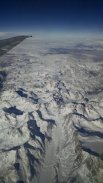
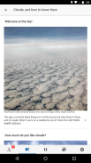
The window is the best kind of in-flight entertainment. Track your flight with GPS - discover the world below with offline maps and POI.
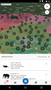
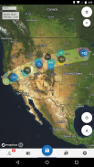
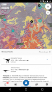
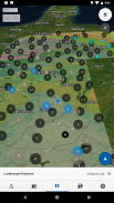
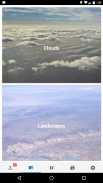
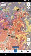
Learn about the world along the path of your flight, hike, or road trip with GPS tracking. Offline geologic maps and interactive points of interest reveal the locations of fossils and georeferenced Wikipedia articles visible from your airplane window seat, road trip, or hiking trail vista.
Follow Flyover Country for updates and photos from the sky!
https://www.facebook.com/flyovercountryapp/
https://twitter.com/flyovergeo
https://www.instagram.com/flyovergeo/
Flyover Country is a National Science Foundation-funded offline mobile app for geoscience outreach and data discovery. The app exposes interactive geologic maps from Macrostrat.org, fossil localities from Neotomadb.org and Paleobiodb.org, Wikipedia articles, offline base maps, and the user’s current GPS determined location, altitude, speed, and heading. The app analyzes a given flight path and caches relevant map data and points of interest (POI), and displays these data during the flight, without in-flight wifi. By downloading only the data relevant to a particular flight path, cache sizes remain reasonable, allowing for a robust experience without an internet connection.
Flyover Country is not limited to the window seat of airplanes. It is also ideal for road trips, hiking, and other outdoor activities such as field trips and geologic fieldwork.
**GPS functionality is only possible from the window seat and GPS reception quality varies by device/conditions**
Das Fenster ist die beste Art von In-Flight Entertainment. Verfolgen Sie Ihren Flug mit GPS - entdecken Sie die Welt unten mit Offline-Karten und POI.
Erfahren Sie mehr über die Welt auf dem Weg Ihrer Flug, Wanderung, oder Straßenfahrt mit GPS-Tracking. Offline geologische Karten und interaktive Sehenswürdigkeiten zeigen die Positionen von Fossilien und georeferenziert Artikel Wikipedia sichtbar aus dem Flugzeugfenster Sitz, Autoreise, oder trail vista wandern.
Folgen Sie Flyover Land für Updates und Fotos vom Himmel!
https://www.facebook.com/flyovercountryapp/
https://twitter.com/flyovergeo
https://www.instagram.com/flyovergeo/
Flyover Country ist ein National Science Foundation geförderten offline mobile App für geowissenschaftliche Öffentlichkeitsarbeit und Datenermittlung. Die App macht interaktive Geologische Karte von Macrostrat.org, fossil Lokalitäten aus Neotomadb.org und Paleobiodb.org, Wikipedia Artikel, offline Basis Karten und die aktuelle GPS-Benutzer bestimmt Position, Höhe, Geschwindigkeit und Position. Die App analysiert einen bestimmten Flugweg und speichert relevante Kartendaten und Points of Interest (POI) und zeigt diese Daten während des Fluges, ohne in-flight Wi-Fi. Durch das Herunterladen nur die relevanten Daten zu einem bestimmten Flugweg, bleiben Cachegrößen vernünftig, so dass für eine robuste Erfahrung ohne Internetverbindung.
Flyover Land ist nicht auf den Fenstersitz von Flugzeugen beschränkt. Es ist auch ideal für Autofahrten, Wandern und andere Outdoor-Aktivitäten wie Exkursionen und geologische Feldarbeit.
** GPS Funktionalität ist nur möglich, aus dem Fenstersitz und GPS-Empfangsqualität durch die Vorrichtung / Bedingungen variiert **


